Canopy Mapping Tool for El Portal
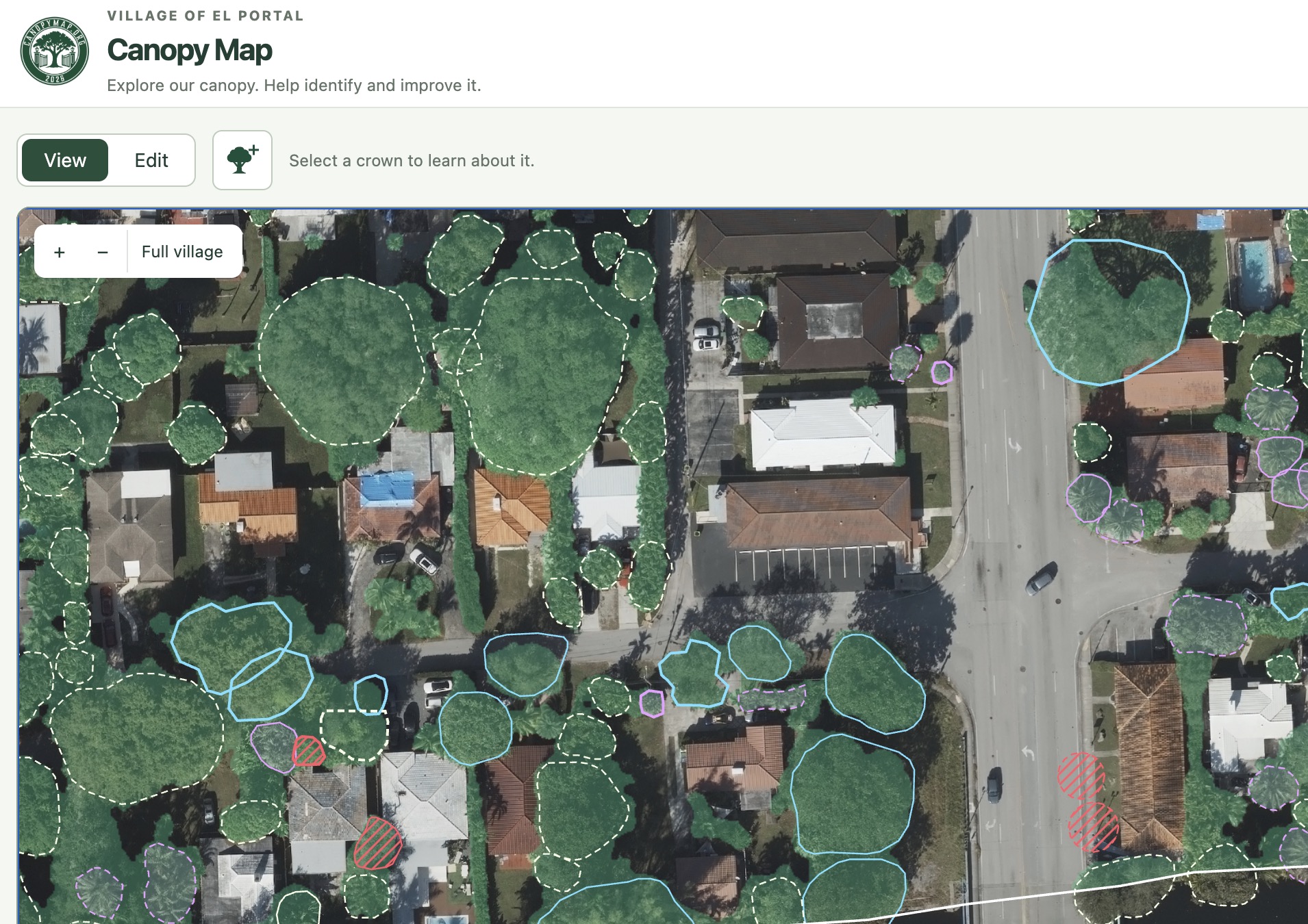
The Village of El Portal is well known for having a leafy tree canopy. It is one of the reasons that I chose to move here. But it is a tiny village with a smaller budget. It can’t easily hire the standard consultants that other cities might hire to map and inventory its trees. As a member of the Tree Board, it became clear that this was preventing us from accessing as many grants as we would otherwise be able to.
Because the citizens of El Portal are very active, and thinking of some previous work with municipal information in Open Street Map, I figured that it might make sense to crowdsource the tree canopy inventory, but every solution I came up with needed an awkward GIS app or had people walking around with tabloid-sized sheets of paper for each block that had to be read and entered by someone else. I wanted to explore a community-built inventory that could complement professional surveys and keep growing as residents contributed their knowledge, and access to their trees.
Finally I decided that a piece of custom software might make the most sense, so I developed CanopyMap.org, a tool for crowdsourcing a tree canopy inventory. The tools starts by running the most recent high resolution aerial imagery through several
We used two existing trained machine-learning models: Restor TCD identifies areas covered by tree canopy. Detectree2 proposes outlines around individual crowns—the branches and foliage visible from above. Separating those tasks lets us estimate overall canopy coverage while building individual records that people can edit.
Anyone can explore or register for CanopyMap.org, and registered contributors can identify species, correct outlines, add missing trees, record trunk diameter and health observations, and mark trees that have been removed. Measurement dates and contributor information help explain where the information came from. The records can also be downloaded in GIS formats for further analysis.
The next goal is to make contributing easier while walking around the village: showing your location, selecting a tree, taking photographs and recording measurements. I would also like residents to suggest planting locations in their swales or front yards.
For the village, the longer-term opportunity is a shared inventory that can incorporate the commissioned arborist’s street-tree survey and support planting, maintenance and research. Eventually, we hope to estimate benefits such as stormwater interception, air-pollution removal and cooling, with clear explanations of the assumptions and uncertainty.